►
From YouTube: GIS Mapping Center
Description
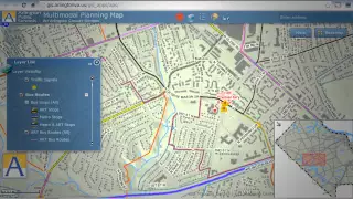
The Department of Environmental Services (DES) is home to the County’s enterprise-wide Geographic Information System (GIS) mapping service. GIS helps visualize, question, analyze and interpret data to understand relationships, patterns and trends. Arlington’s GIS team uses the latest technology and industry expertise to provide mapping and analysis services that produce visually appealing and informative maps to better inform decisions and tell a more compelling story. Learn more!
A
Do
you
know
where
you
can
plan
your
family's
next
picnic
in
nature,
walk
travel
back
in
time
without
leaving
your
chair
or
maybe
take
a
tour
of
Arlington
County's
public
art.
Even
when
it's
raining
well
here
at
Arlington,
County's
GIS
mapping,
Center,
we
can
help
you
do
all
of
this
and
more
from
your
desktop
computer
or
mobile
device.
A
Gis
stands
for
geographic
information
systems
and
we
gather
and
analyze
data
to
create
maps,
charts
and
3d
models
of
the
world
around
you,
whether
it's
planning
a
safe
route
to
school
for
your
child
or
planning
a
bike
route
on
over
100
miles
of
trails.
We've
got
you
covered
and
if
you
need
a
bike,
we
can
show
you
where
all
the
Capital
Bikeshare
stations
are
repair
stations
and
restrooms
for
your
next
adventure
on
wheels.
A
Finding
the
nearest
police
station
fire,
hydrant
bus,
stop
or
voting
station
couldn't
be
easier
thanks
to
Arlington,
County's,
GIS
mapping,
Center
our
team
supports
Arlington's
residents,
county
government
and
other
organizations.
We
provide
aerial,
photo
analysis,
data
maintenance,
digitizing
support
and
much
more.
Providing
these
tools
empowers
you
to
make
better
informed
decisions
about
your
work,
life
and
Recreation.
In
the
county,
see
what
GIS
is
doing
for
Arlington
and
see
what
it
can
do
for
you
visit
maps,
Arlington,
Va,
dot,
Us
and
get
started.