►
From YouTube: Comprehensive Land Use Plan
Description
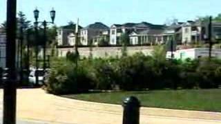
Buncombe County is in the process of updating their Comprehensive Land Use Plan. This video gives an overview of what the plan is and how it will benefit the citizens of Buncombe County.
A
Buc
Abdali
is
blessed
with
abundant
natural
and
scenic
resources
that
are
drawing
more
and
more
people
to
locate
to
this
community.
Our
resources,
although
beautiful,
are
limited
because
of
the
incredible
growth
in
our
County.
There
have
been
many
changes
of
land-use.
What
used
to
be
rolling
hills
of
pasture
land
or
gardens
are
now
subdivisions
or
strip
malls.
This
land
use
pattern
results
in
both
desirable
and
undesirable
consequences.
A
Positive
impact
of
growth
is
an
increase
of
a
number
of
jobs
and
housing
for
our
citizens.
A
variety
of
negative
impacts
include
the
elimination
of
rural
farmland,
a
continual
mix
and
increase
in
residential
and
commercial
traffic
and
incompatible
uses.
These
conditions
raise
several
concerns
regarding
our
scenic
and
environmental
qualities,
economic
development,
potential
quality
of
life
for
our
citizens
and
infrastructure
capacities.
A
key
responsibility
of
the
county
is
to
make
the
best
possible
investment
of
public
funds
as
it
pertains
to
land
use
and
the
county's
development.
A
A
What
is
a
comprehensive
land
use
plan?
The
purpose
of
a
land
use
plan
is
to
accomplish
three
goals:
to
understand
the
current
conditions
and
resources
the
county
and
determine
what
trends
are
taking
place
to
define
the
growth
opportunities
available
and
decide
what
tools
are
required
to
take
advantage
of
these
opportunities,
establish
a
vision
for
the
county's
future
and
develop
a
current
land
use
plan
that
guides
each
facet
of
a
community
toward
that
general
vision,
the
public
has
expressed
concerns
about
the
purpose
of
a
comprehensive
land
use
plan.
A
Will
a
revision
of
the
land
use
plan
dictate
the
way
citizens
can
use
their
property?
No.
A
land
use
plan
will
ascribe
broad
patterns
of
land
development
which
can
be
used
by
citizens,
industries
and
utilities
to
map
that
growth
in
their
specific
interest.
The
plan
can
then
be
used
as
a
reference
for
school
construction,
recreation
parks
and
utility
expansion
planning.
How
is
the
lane
use
plan
and
different
from
zoning?
A
land
use
plan
does
not
in
itself
creates
or
place
zoning
restrictions
on
property.
A
land
use
plan
is
simply
a
plan,
not
regulations.
A
A
plan
does
not
require
a
citizen
or
agency
to
use
his
or
her
property
in
a
particular
way,
nor
does
it
require
a
person
to
use
his
or
her
property
differently
from
the
way
it
has
been
used
in
the
past.
Zoning
is
a
form
of
land
use
regulation
which
establishes
basic
rules
for
how
development
occurs
and
what
uses
are
allowed.
A
The
current
land
use
plan.
The
current
land
use
plan
was
adopted
by
the
Board
of
Commissioners
in
March
of
1999.
The
plan
is
a
tool
until
it's
a
guide
future
commercial,
residential
and
industrial
development
in
the
communities
that
make
up
buckin
County
using
the
land
use
plan
as
a
guide
helps
preserve
land
and
resources,
restrict
negative
impacts
of
urbanization
or
promote
growth
where
it
is
deemed
appropriate.
A
land-use
plan
requires
a
methodical
and
thorough
inventory
and
analysis
and
public
inputs.
The
current
land
use
plan,
although
adopted
in
1999,
began
its
development
in
1997.
A
All
of
the
following
factors
were
considered
the
current
land
use
plan
and
will
be
reviewed
at
the
updated
land-use
plan
that
is
being
developed.
Imported
environmental
factors
shaping
growth
in
Buncombe
County
include
national
and
state
forests.
Watershed
basis,
rivers
and
streams,
lakes,
forests,
soils
slopes,
prime
and
imported
farmland
and
designated
environmental
areas,
transportation
factors
effecting
growth
in
the
region
include
existing
and
future
interstate
highways,
arterioles
rail
lines
and
airports.
A
Physical
infrastructure
systems
effecting
growth
in
the
region
include
existing
and
planned
water
and
sewer
lines,
gas
service
and
electric
service
urbanization
factors
affecting
the
region
encompass
past
urban
development
and
growth,
as
well
as
population
change
within
the
metropolitan
area.
In
the
current
land
use
plan,
land-use
is
most
commonly
low-density
subdivisions
and
commercial
sitter's
scattered
throughout
the
county.
Demographic
factors
studied
include
population
growth,
age,
income,
educational
attainment,
housing
values
and
density.
A
Historical
resources
within
the
region
were
documented,
including
historic
districts,
museums
and
individual
size.
Culture
and
arts
facilities
include
museums,
theaters,
auditoriums,
pavilions
and
teaching
facilities,
medical
facilities,
including
hospitals
and
specialty
hospitals.
The
commercial
development
of
the
region
includes
retail
industrial
office
and
hotel
development.
Educational
facilities
include
colleges,
community
colleges
and
universities.
A
The
future
land-use
plan
conditions
in
Buncombe
County
have
changed
since
the
current
land
use
plan
was
adopted
in
1999.
The
economic
forces
and
favorable
market
has
increased
development
in
all
areas
of
the
county.
One
has
to
wonder
how
has
this
effect
of
the
quality
of
life
in
our
area?
How
is
development
affected
our
environment?
In
what
ways
can
we
improve
our
economic
development?
How
should
we
guide
future
development
to
enhance
investment
while
protecting
what
we
do
not
want
changed?
How
should
infrastructure
funds
be
spent?
A
A
Land
Use
Plan
can
under
S
these
issues
with
alternative
strategies
and
implementation
goals.
Buncombe
County
is
in
the
process
of
updating
its
comprehensive
land
use
plan.
An
updated,
comprehensive
land-use
plan
will
help
define
how
growth
and
preservation
should
be
guided
for
the
next
ten
years.
It
is
the
right
of
every
citizen
to
express
your
concerns
and
desires
for
the
future
growth
of
Buncombe
County.