►
From YouTube: The North Trail Study Area Plan
Description
The City of Boulder’s Open Space and Mountain Parks (OSMP) Department needs the help of our community to develop the North Trail Study Area Plan. This plan seeks to improve visitor experiences on OSMP lands north of Linden Avenue and the Diagonal Highway by creating high-quality recreational amenities that are compatible with the city’s natural, cultural and agricultural conservation goals. Learn more about this plan at http://NorthTSA.org.
A
For
more
than
a
century,
boulder
residents
have
worked
tirelessly
to
safeguard
the
incredible
landscapes
around
them.
Today,
therefore,
sight,
along
with
their
decades-long
work,
to
develop
unique
recreational
opportunities
for
our
community,
have
created
a
highly
popular
public
land
system
that
draws
more
than
5.3
million
visits
every
year
when
people
think
of
boulders
open
spaces,
they
often
picture
the
iconic
flat
irons
in
the
Chautauqua
meadow,
yet
the
landscapes
that
stretched
north
of
Boulder
are
equally
important
to
the
city's
open
space
and
mountain
park
system.
These
breathtaking
public
lands
are
home
to
diverse
and
rich
open
spaces.
A
Foothills
lined
with
ponderosa
pines,
provide
a
scenic
backdrop
in
areas
of
native
grasslands,
connect
us
to
the
great
expanse
of
prairie
that
once
covered
Boulder
County
and
create
opportunities
for
farmers
and
ranchers.
These
lands,
north
of
Boulder
are
also
dotted
with
lakes
ponds
and
riparian
areas,
and
they
have
fascinating
geologic
features
that
provide
habitats
for
native
vegetation.
The
lands
north
of
Boulder
are
also
home
to
many
wildlife
species,
including
dear
prairie,
dogs
and
rare
species
of
butterflies.
A
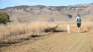
Every
day,
thousands
of
people
travel
along
a
20-mile
network
of
trails
that
stretch
across
boulders
northern
public
lands.
These
visitors
enjoy
a
wide
range
of
passive
recreational
activities
to
connect
with
the
land,
Boulder
residents
and
visitors
from
all
over
enter
these
spectacular
landscapes
through
seven
trail,
heads
and
other
access
points
open
space
and
mountain
parks
is
now
developing
a
management
plan
to
ensure
the
continuing
sustainability
of
these
lands
and
the
trails
that
stretch
along
them.
A
The
north
trail
study
area
plan
which
encompasses
open
space
and
mountain
parks,
public
lands,
north
of
linden
avenue
and
the
diagonal
highway
will
provide
a
framework
for
sustainable
trail
system.
This
plan
will
also
identify
visitor
amenities
that
are
compatible
with
the
city's
natural,
cultural
and
agricultural
resource
conservation
goals.
A
We
need
the
input
of
our
community
to
help
shape
and
identify
priorities
for
this
plan,
which
will
include
recommendations
for
improving
the
trail
system
and
managing
or
restoring
and
designated
trails.
This
plan
may
also
include
proposals
for
trailhead
improvements,
trail
reroutes
for
special
resource
and
activity
management
measures
to
learn
more
about
the
north
trail
study
area
plan
and
ways
you
can
help
us
to
develop.
It
go
to
North
TSA
org.
We
need
your
help
to
ensure
that
this
wonderful
area
is
maintained
and
sustained
for
future
generations.