►
From YouTube: Land Use and Cummins Highway Reconstruction
Description
Virtual meeting held on August 17, 2021 at 6:30 P.M. by the Boston Public Works Department, Boston Transportation Department and the Boston Planning and Development Agency to talk about how our departments collaborate. We discussed how land use influences transportation decisions, from master plans to individuals moving around everyday.
This event is part of a series of meetings the Public Works Department is hosting to inform the final design for the reconstruction of Cummins Highway.
For more information visit boston.gov/cummins-highway
A
A
A
C
D
F
A
Thank
you,
but
before
we
start
the
meeting,
I
just
wanted
to
mention
and
acknowledge
that
there's
also
another
meeting
the
city
planned
for
today.
So
isd
is
hosting
a
meeting
about
unsanctioned
backyard
events.
I
will
drop
the
link
in
a
second,
so
this
meeting
will
be
recorded.
So
if
you
feel
like
that
is
an
important
meeting
for
you
to
attend,
please
go
and
then
we'll
make
sure
to
send
you
a
link
to
this
recording.
A
That
said,
I
just
wanted
to
briefly
go
over
sort
of
what
we
are
here
today.
This
will
be
a
great
meeting.
I
just
wanted
to
reiterate.
Like
the
reconstruction
is
happening,
we
want
it.
One
of
the
questions
we
get
asked
fairly
often
is:
how
do
we,
collaborate
and
sort
of
how
do
these
double
meetings
tend
to
happen
and
now
sort
of
the
work
that
we
do
together
and
collaboration
we
do
together.
A
And
then
how
does
decision,
making
around
land
use
impact,
transportation
and
mobility
and
then
for
learning
about
the
transportation?
Sorry,
the
common
sideways
with
construction
projects.
I
want
to
give
an
overview
sort
of
the
guiding
principles
and
goals
that
we
are
working
to
achieve
in
this
project
and
how
your
input
is
utilized
through
the
design
process
and
what
else
we
use
as
input
for
design
and
upcoming
opportunities
to
provide
sort
of
more
design,
specific
inputs.
C
All
right
good
evening,
everyone
to
give
you
to
jump
into
a
brief
summary
of
the
cummins
highway
project
reconstruction
project
just
want
to
let
everybody
know
what
you're
seeing
right
now
in
commerce
highway
as
a
temporary
redesign
of
slow
speeding
drivers
and
to
improve
safety
for
all
users.
While
we
work
on
the
design
for
the
reconstruction
project
as
right
now,
you're
also
seeing
national
grid
out
there.
C
C
C
So
reconstructing
cummins
highway
public
works,
along
with
the
boston
transportation
department
plan
to
completely
rebuild
the
street.
That
includes
reconstructing
the
sidewalks,
putting
putting
in
a
new
curb
a
resetting
curb
installing
new
street
lights
along
the
corridor
traffic
signals.
We
are
planning
on
repaving
the
road
and
replace
or
update
any
utilities
as
necessary.
C
The
center
the
city
currently
has
this
project
budgeted
at
12
million
dollars
to
reconstruct
comments
highway
from
river
street
down
to
the
wood
avenue
and
harvest
region
intersection.
But
we
are
also
looking
at
hopefully
making
improvements
to
the
section
between
wood
avenue
and
american
legion
highway
as
well.
That's
still
in
the
works,
but
that's
something
that
we're
looking
at,
because
that
is
there's
also
a
request
that
we've
gotten
from
the
community.
C
So
before
moving
forward,
we
wanted
your
input.
We
cannot
produce
a
design
without
your
input.
You
will
help
shape.
How
come
it's,
how
it
should
be
for
the
next
70
years
as
danielle
daniela
mentioned,
we
are
going
to
be
constructing
companies
highway.
I
mean
how
it
looks
for
the
next
70
years
or
something
is
the
process
that
we're
going
through
right
now.
Currently
we're
doing
community
outreach
to
inform
the
final
design,
but
we
have
not
begun
engineering
work
to
design
the
quarter
and
we're
still
strictly
working
on
engagement.
C
C
So
one
of
the
major
departments
that
we've
actually
been
working
with
is
the
boston
planning
and
development
agency,
the
bpda,
which
is
the
planning
and
economic
development
agency
for
the
city
of
boston.
The
bpda
works
with
people
in
communities
across
all
neighborhoods
of
boston
to
plan
and
build
for
the
future
of
the
city.
The
planning
department
specifically
works
with
the
community
to
create
long-term
visions
for
places
the
pda
collabs
with
many
departments,
including
the
public
works
department
and
transportation
department.
D
So
I'm
happy
to
discuss
a
little
bit
more
about
what
we're
doing
at
the
vpda,
specifically
in
matapan
and
through
the
plan
manifem
process.
Many
of
you
will
have
recognized
me
or
someone
on
this
call
or
just
the
name
plan
matapan
plain
mana
began.
Plan.
Matapan
is
a
neighborhood
wide
planning
initiative
that
works
closely
with
the
community,
to
review
past
planning
efforts
and
identify
needs
and
opportunities
for
improvements
which
will
support
the
long-term,
equitable,
equitable
growth
and
sustainability
of
the
neighborhood.
D
The
vision
statement
that
we
collectively
worked
on
and
came
up
with
is
plan.
Matapan
will
strengthen
the
existing
culture
and
stability
of
the
community
by
supporting
affordable
housing,
creating
opportunities
for
businesses
to
thrive
and
enhancing
connections,
to
improve
the
neighborhoods
experience
accessing
jobs
and
spaces
where
people
gather,
for
the
purposes
of
today's
conversation,
we're
going
to
be
focusing
on
this
last
piece
here:
enhancing
connections
to
improve
the
neighborhoods
experience
accessing
jobs
in
spaces
where
people
gather
so
mobility
is,
is
a
core
part
of
the
work
that
we're
doing
in
plan
matapan
next
slide.
D
D
So
some
of
the
outcomes
of
this
planning
initiative
would,
you
know,
foresee
changing
the
zoning
code,
and
that
would
be
that
area
in
yellow,
but
the
majority
of
our
time
has
been
spent
focusing
on
that
area
and
the
dash
blue
as
a
part
of
plan
matapan.
We
study
housing,
economic
development,
climate
change,
the
environment
and,
of
course,
mobility.
D
We
do
this
through
understanding
existing
conditions,
as
well
as
community
values
and
goals,
and
this
is
done
through
community
conversations,
whether
that
be
a
chat
with
a
planner
pop
schools,
with
a
planner
meetings
such
as
this
or
simply
just
engaging
regularly
throughout
the
year.
We
have
a
community
engagement
manager,
kenya
beeman,
who
does
a
lot
of
that
work
for
us
as
well.
D
First
and
foremost
you,
the
community,
is
involved
in
all
of
our
planning
initiatives.
We
make
sure
that
we
are
advertising
we're
out
in
your
neighborhood.
You
are
familiar
with
our
faces
and
we
really
want
to
make
sure
that
every
voice
in
the
matapan
the
community
is
heard
through
this
process
and
all
of
our
processes.
We
also
collaborate
with
city
of
boston
departments,
including
btd,
public
support,
public
works,
dnd,
the
office
of
economic
development,
the
environment
department
and
parks
as
well.
D
D
We
also
work
with
the
state
of
massachusetts
or
the
commonwealth,
so
we
work
with
massdot
or
the
department
of
transportation
with
the
commonwealth.
We
work
with
the
t
and
we
also
work
dcr.
So
this
is
not
just
the
bpda
or
any
one
person
sitting
in
a
room
and
kind
of
coming
up
the
vision
for
matapan.
There
are
a
lot
of
people
involved,
there's
a
lot
of
voices
and,
most
importantly,
when
we
make
sure
that
we
hear
yours
next
slide.
D
So
some
of
those
goals
that
we've
come
up
with
over
the
last
three
years
and
they're
ever
evolving.
So
these
aren't
quite
you
know
what
you'll
see
later
this
year,
but
under
housing
we
really
want
to
encourage
affordable,
stable
and
diverse
housing
options
in
matapan
to
reduce
displacement
and
maintain
homeownership
levels.
Matapan
has
one
of
the
highest
rates
of
homeownership
in
the
city
under
people
and
places
we
want
to
guide
new
projects
to
contribute
to
strengthening
the
existing
culture
and
celebrating
matapan's
identity.
D
Mattapan
has
a
very
rich
history
and
we
don't
want
that
to
be
ignored.
Just
because
you
see
new
development
or
new
projects
coming
into
the
neighborhood
under
environment
and
climate
change.
We
really
want
to
improve
quality
of
life
by
promoting
healthy
environments,
preparing
for
climate
change.
This
includes
community
resilience,
so
making
sure
you
know
who
your
neighbors
are:
it's
about:
creating
a
walkable
environment,
reducing
heat
island
effect
and
improving
air
quality
jobs
and
businesses.
D
We
want
to
drive
inclusive
economic
growth
through
support
for
local
economies
and
increase
access
to
opportunities
within
and
external
to
matapan.
This
includes
getting
folks
to
their
to
major
job
centers,
whether
that
be
in
boston
out
of
boston
or
job
centers
that
are
in
matapan.
We
also
want
to
support
the
local
industries
in
matapan
itself.
We
want
to
see
restaurants,
artists,
retailers,
etc,
thrive
in
matapan
and
last
but
not
least,
and
certainly
important.
For
tonight,
mobility.
D
We
want
to
see
an
increase
in
access
to
high
quality
travel
options
so
that
people
can
safely
and
reliably
connect
to
destinations
within
matapan
and
the
rest
of
the
city.
This
can
be
done
in
a
variety
of
ways:
maybe
you're
walking
to
matapan
square
or
to
morton
street,
maybe
you're,
taking
your
bike
to
the
napanzen
river
greenway
to
connect
to
hyde
park
in
the
future
or
to
dorchester.
D
D
E
E
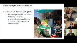
I
think
you
know
the
goals
are
summarized
here,
but
they
come
a
lot
not
just
from
the
city's
planning
initiative,
which
was
go
boston
2030,
which
is
you
know,
something
we
build
upon
in
our
planning
initiatives
as
well,
but
in
previous
conversations
we've
had
with
the
community
and
a
lot
of
things
that
came
up
were
around
safety.
How
do
you
cr
you
know?
Crossing
blue
hill
avenue
is
not
fun,
I
you
know
and
there's
a
lot
of
different
ways
to
do
it.
I've
seen
a
lot
of
people
differ
or
do
it
differently.
E
So
it's
a
lot
of
you
know
zigzagging
here
and
there
so
something
to
keep
in
mind
and
then
other
things
we've
heard
a
lot
about
is
just
you
know:
people
wanting
to
go
to
different
destinations,
so
walking
to
matapan
square.
Isn't
something
that
a
lot
of
people
do.
A
lot
of
people
use
their
cars
to
get
to
a
lot
of
different
destinations,
but
the
everyone,
a
lot
of
people
were
saying
in
surveys
that
we
put
out
that
you
know.
E
So
one
of
the
things
we
heard
a
lot
about,
obviously,
and
as
part
of
our
goals,
is
around
community.
So
how
can
we
use
land
use
so
the
things
that
we
work
on,
meaning
the
types
of
things
you
see
in
your
environment
and
in
your
neighborhood
and
and
combine
that
with
mobility
and
transportation
to
actually
enhance
how
our
community
works
with
each
other
interacts
with
each
other
and
stuff
like
that,
so
one
of
the
ways
in
which
we
address
that
is
through
these,
this
idea
of
nodes.
E
So
really
what
a
node
is
is
similar
to
like
what
matapan
square
is
it's
a
place
where
you
see
commercial
housing?
Retail,
you
see
a
bunch
of
different
uses
all
in
one
place,
and
what
that
does
is
it
promotes
people?
You
might
hear
my
child
screaming
in
the
background
I
apologize
in
advance,
he
is
in
the
bath.
I
will
now
regress.
E
So
one
of
the
things
that
we
see
here
is
that
you
know
people
like
to
go
to
these
places
to
meet
their
friends
to
you
know
access
all
these
different
goods
and
services,
but
one
of
the
things
is
that
it
doesn't
exist
all
around
matapan.
We
see
it
in
the
square,
but
if
we
decentralize
that,
if
we
actually
look
at
these
different
opportunities
for
nodes
throughout
the
neighborhood
you're,
actually
creating
opportunities
for
more
people
to
meet
in
different
places
also
to
get
there
in
different
ways.
E
And
so
one
of
the
things
that
plan
matapan
tries
to
emphasize
is
that
we
want
to
create
more
opportunities
for
people
to
stop
to
people
to
walk
to
their
destinations
and
get
to
places
that
they
want
to
go
to
next
slide.
Please
so
another
big
thing,
and
that
we
just
mentioned
this
before,
is
around
safety
and
access.
E
E
We've
heard
many
times
that
people
don't
feel
safe
biking
on
cummins
highway
people
don't
feel
safe,
necessary
or
comfortable
walking.
I
mean
it's
not
a
very
comfortable
environment
when
cars
and
you
know,
trucks
etc,
are
speeding
past
and
so
we're
really
trying
to
find
opportunities
to
make
it
so
they
it
is
a
more
walkable
and
more
safe
and
accessible
place
that
people
can
use
next
slide.
Please
and
then
healthy
environments.
E
So
a
healthy
environment
is,
I
think,
one
of
the
most
important
things
that
we've
heard
through
this
process,
especially
around
not
just
around
climate
change,
but
also
around
just
how
we
move
through
space,
how
we
experience
our
neighborhoods
health
of
the
environment,
the
health
of
the
community
and
the
environment
our
length.
So
if
streets
and
buildings,
all
these
things,
impact
the
po
and
public
realm
impact
health.
E
So
not
only
does
tre
street
trees
and
also
creating
opportunities
for
different
modes
of
transit
impact,
the
health
and
safety
of
the
community,
but
also
impacts
the
health
and
safety
of
the
environment,
and
so
those
things
are
very
closely
tied
together,
and
I
think
you
know
we-
we
should
emphasize
that
throughout
all
these
different
processes.
So
here
you
just
see
a
map
that
was
produced
of
all
the
different
open
spaces
and
people
who
have
access
to
those
open
spaces.
So
when
you
see
the
grayer
areas,
those
are
underserved
to
open
space.
E
So
if
we
can
either
create
more
open
spaces
in
public
sorry
public
open
spaces,
then
we
create
more
access
or
we
have
to
create
better
modes
of
getting
to
those
places.
Next
slide.
Please
so
how
does
this
impact
the
redesign
of
coming
sideways
like?
How
does
anything
I
just
talked
about
really
actually
interact
with
clemens
highway,
and
it
does
because
everything
that
we
talk
about
through
plan
matapan,
be
it
about
housing,
mobility,
the
environment,
climate.
You
know,
jobs
and
businesses.
E
All
of
these
things
actually
are
translated
and
and
reinterpreted
and
shared
with
our
sister
agencies.
So
with
btd
with
public
works
and
all
of
the
others.
You
know
the
department
of
neighborhood
development
et
cetera,
so
the
cummins
highway
redesign
is
actually
just
an
op.
Is
another
opportunity
to
implement
these
values,
we're
we're
benefiting
from
the
fact
that
this
is
happening
at
the
same
time,
because
we're
able
to
translate
the
values
and
goals
we've
heard
through
our
process
to
the
public
works
and
btds
process.
E
So
that's
just
something
we'd
like
you
know,
for
people
to
keep
in
mind
like
I,
I'm
very
excited
to
see
what
comes
of
this,
and
I
hope
that
you
know
the
values
and
goals
of
the
community,
plus
the
values
and
goals
that
are
expressed
in
plan
matapan
all
make
it
and
are
kind
of
come
to
fruition
through
this
process
as
well.
Next
slide,
please
so
to
just
close
out
our
section
a
little
bit.
We
have
done
a
lot
of
planning
workshops
in
the
past.
E
E
We
rely
on
our
agencies
on
the
agencies
within
the
city
and
departments
within
the
city
to
implement
the
majority
of
our
planning
initiative.
So
the
boston
planning
and
development
agency
can
write
into
can
impact
zoning,
but
a
lot
of
what
we
hear
also
has
to
be
implemented
by
the
boston
transportation
department
by
public
works
department
by
the
department
of
neighborhood
development,
et
cetera,
et
cetera,
et
cetera.
So
anything
that
comes
to
us
is
really
we
play
the
facilitator
and
actually
translating
some
of
these
things
to
get
to
happen
in
the
future.
E
So
that's
what
we're
working
on
currently
coordinating
and
we'll
be
sharing
those
out
likely,
starting
in
the
next
few
months,
so
be
on
the
lookout.
For
that
I
know
that's
towards
the
end
of
this
presentation,
but
I
did
want
to
transition.
I
think
daniella
will
be
presenting
now
on
a
little
bit
more
on
cummins
and
our
relationship
with
their
work.
A
Yeah,
thank
you
yeah.
So
as
maxey
and
jared
mentioned,
we
meet
very
often
talk
about
sort
of
how
their
plan
is
going
and
sort
of
the
input
that
they're
getting.
And
if
it's
related
to
comments,
we
we
take
that
input
and
sort
of
look
at
what's
possible,
but
one
of
the
things
that
hasn't
happened
to
that
then
is
sort
of
the
realization
of
that
plan.
A
So
one
of
those
is
the
fair
month,
indigo
planning
initiative
and
this
through
this
study,
which
is
related
to
the
farm
online
line
and
if
you're
not
familiar.
Although
many
of
you
are
there's
a
blue
hill
avenue,
transit
stop
there
for
the
fairmont
line,
which
is
in
between
blue
hill
avenue
and
cummins,
and
this
study
is
sort
of
corridor
wide
and
it
looks
at
different
stops.
A
It
looks
at
what
commercial
and
residential
opportunities
are
there
for
development
transit
improvements
for
transit
access,
public
ground
and
community
building
initiatives,
and
so
it
details
for
each
stop
and
for
each
community,
but
also
it
has
specific
recommendations
for
commons
highway,
which
included
improving
the
pedestrian
connections
to
this
rail
line
between
madap
and
square
and
the
station
entry.
Improving
pedestrian
safety
like
including
the
sidewalk
width
and
reducing
the
curb
cuts
and
improving
the
crossings
that
exist
already.
B
A
One
of
the
other
big
plans
that
underwent
in
2018
and
that
was
released
and
that
we
follow
is
the
city's
comprehensive
transportation
plan
which
is
go
boss
in
2030
and
in
there
you
will
find
all
of
our
goals
and
targets
which
passed
their
community
process
and
were
built
together,
and
so
they
include
sort
of
like
the
vision
of
the
city
for
the
next.
Yes,
until.
G
C
Hello
again
and
everyone
so
to
emphasize
and
kind
of
reiterate
the
major
goals
of
the
reconstruction
of
cummins
highway.
It's
to
make
the
roadway
safer
and
more
accessible
the
city
as
long
as
as
well
as
the
residents
that
we
spoke
to
from
the
neighborhood,
we
want
to
transform
cummins
highway
into
a
tree-lined
neighborhood
street
that
is
safer
for
families,
to
walk,
wait
for
the
bus
ride,
bikes
or
I
mean
as
well
as
travel
by
vehicle.
We
like
this.
C
In
that
time,
we've
also
had
attended
a
number
of
neighborhood
association
meetings,
as
well
as
had
a
couple
of
pop-ups
at
the
mattapan
farmers
market
on
fairway
street.
But
the
the
community
engagement
is
ongoing
for
this
project.
We
have
we
have
we.
We
have
had
a
number
of
engaged
opportunities
in
june
and
july,
where
we
had
a
special
talk
with
to
discuss,
arrested
mobility
with
matapan
food
and
fitness
with
charles
brown.
C
We
we've
looked
at
the
heat,
resiliency
and
we've
talked
about
air
quality
along
the
corridor
as
well
in
august.
We're
talking
about
land
use
in
this
meeting
of
course,
but
we
also
have
a
number
of
engagement
opportunities
lined
up,
I
mean
in
september.
We
want
to
talk
about
lighting
and
also
we
want
to
talk
about
public
health
and,
in
november,
we're
going
to
talk
about
and
beyond,
we'll
talk
about
green
infrastructure,
trees,
the
roundabouts
and
all
and
other
pedestrian
improvements
that
we're
proposing
as
part
of
this
project.
C
I
just
wanted
to
know
that
we
do
keep
recordings
of
of
these
meetings
on
our
web
page.
We
definitely
want
you
if
you
missed
them.
Please
look
into
them.
You
kind
of
see
what
we
have
planned
and,
and
and
I
mean
if
you
want
to
reach
out
for
discussions
to
talk
to
us-
we're
available
because,
as
I
mentioned,
like
your
input
is
very
important.
So
before
we
kind
of
move
in
move
forward
with
the
design
of
the
comments
higher
reconstruction,
we
want
to
continue
having
that
engagement
process
going.
C
So
the
input
that
we've
been
using
to
inform
the
reconstruction
of
cummins
highway,
ultimately,
is
the
data
collection
analysis.
Our
our
engineers
collect
traffic
volumes
and
model
the
traffic
flow
that
we've
conducted
a
number
of
observations
and
evaluate
available
crash
data
along
cummins
highway.
More
information
about
this
data
that
we
are
collecting
is
available
on
the
boston.gov
backslash
cummins
dash
highway.
C
If
you,
if
you
caught
that,
yes,
so
the
second,
the
second
and
I
would
say
a
very
important
aspect
of
of
informing
the
coming,
how
come
it's
higher
reconstruction
is
community
input.
Community
input
receive
is
used
to
inform
our
understanding
of
the
corridor
and
create
the
final
design
for
the
reconstruction.
C
Next
slide,
please
and
lastly,
we
want
to
follow
best
practices.
We
follow
our
design
guidelines
and
endorsed
by
the
city,
the
state
or
other
federal
agencies,
and,
as
I've
mentioned,
we
consult
with
peers
around
the
country
for
the
best
practices
and
engineering
practices
to
address
a
lot
of
the
concerns
that
many
residents
have
expressed,
whether
it's
the
the
speeding,
whether
it's
the
traffic
congestion,
where,
whether
it
when
residents,
don't
feel
safe,
walking
or
biking
along
the
corridor.
C
C
So
we
will
continue
to
have
conversations
with
you
about
the
redesign
of
cummins
highway.
Your
input
during
these
discussions
will
be
used
to
inform
the
design
of
comments
and
we
will
and
will
be
shared
with
other
departments
to
inform
their
work
as
well.
In
june,
we
hosted
a
specialty
talk
with
charles
t
brown
to
discuss
ways.
Mobility
of
black
americans
is
limited
in
the
us,
through
police
policies
and
politely
and
in
july
we
hosted
two
virtual
meetings
with
the
environment
department.
C
Next
slide,
please
to
kind
of
summarize
what
we've
heard
from
those
meetings
at
this
city's
heat
brazilian
study
on
the
redesign
on
commerce
highway.
We
heard
that
residents
want
us
to
add
more
shade
along
cummins
highway.
They
wanted
us
to
plant
trees
and
and
and
look
at
installing
bus
shelters
along
the
corridor.
You're
also
concerned
about
the
temporary
design
and
its
pack
impact
on
emergency
services
and
traffic,
as
well
as
trash
trucks.
C
When
we
talked
about
air
quality,
what
we've
heard
from
the
community
is
that
you
are
interested
in
monitoring
and
quality
along
the
corridor.
We
also
look
at
locations
where
air
qualities
can
be
located
in
the
project
area
and
as
I've
mentioned,
residents
were
concerned
about
temporary
the
temporary
redesign
on
companies
highway
and
how
the
traffic
might
also
be
reflecting
the
air
quality
along
the
corridor.
C
So,
lastly,
next
steps
you
mean
stay
tuned
for
the
workshops
that
we're
planning
on
hosting,
to
discuss
the
design
elements
on
cummins
highway.
We
have
a
street
lighting
and
comes
how
a
redesign
meeting
scheduled
for
september
21st
and
then
we
hope
on.
We
hope
to
look
forward
to
planning
a
green
structure.
Meeting
we'll
be
planning
on
looking
at
the
trees
along
and
potential
locations
could
be
for
trees,
anchored
infrastructure
and
also
we
plan
on
looking
at
the
roundabout
and
it
comes
our
design.
C
D
So
we
have
some
ongoing
temporary
public
art
activation
happening
in
the
neighborhood.
Some
of
you
have
been
aware
of
that.
You
should
be
seeing
a
mural
going
up
at
the
corner
of
regis
road
and
of
blue
hill
avenue,
and
then
the
bpda
is
also
working
and
coordinating
with
mapc
on
the
naponzit
greenway
extension
work.
This
is
there's
actually
a
lot
of
people
who
are
involved
in
the
napons
at
greenway
extension.
D
The
bpda
and
the
matapan
team
specifically
is
working
with
mapc
to
find
the
gaps
between
those
various
projects
and
really
work
to
make
sure
that
we
are
filling
those
gaps
and
creating
a
continuous
greenway
extension
to
hyde
park,
for
any
other
updates
feel
free
to
check
us
out
on
our
website.
At
vit
period.
L
y
plan
matapan
or
you
can
connect
with
kenya
beeman,
who
is
our
community
engagement
manager
and
matapan
resident
and
her
email
address?
Is
there
as
well
and
then
daniella
for
cohen's
highway.
A
A
A
Highway
and
then
we
host
a
every
other
wednesday,
we
host
a
chat
with
us
or
chat
with
a
project
manager
or
a
member
of
our
team.
You
can
have
15
minutes
of
time
with
us
to
just
sort
of
go
over
your
questions
or
give
us
your
input
and
we
can
sort
of
talk
through
anything.
You
want
those
happen
every
other
wednesday
from
three
to
seven.
So
the
in
order
to
sign
up
you
can
just
go
to
bid.ly
slash,
come
in
15
and
then
just
pick
a
time
and
we'll
be
there.
A
H
A
Doing
in
matapan,
and
so
there's
some
resources
available
on
friday
august
27th
there's
going
to
be
near
jamie's
matapan
coffee
hour.
So
this
is
an
opportunity
to
speak
directly
to
the
mayor,
but
also
staff
from
other
student
departments.
Not
only
us,
but
also
the
isd
will
be
there
if
you're
gonna
make
it
to
the
meeting
today.
A
Maybe
who
knows
anybody
could
be
there
and
it
will
be
in
up
in
space,
so
there'll
be
a
park
to
enjoy.
There
will
also
be
coffee,
maybe
some
donuts,
I
see
magazines
going
to
be
there,
so
you
can
feel
free
to
drop
by
between
10
30
and
11
30
a.m
at
allman
park
at
the
same
park,
every
tuesday,
if
you
didn't
know,
there's
also
a
family
zumba
with
carmen
from
six
to
seven.
A
This
is
a
program
hosted
by
the
boston
parks
and
recreations
department
and
boston,
public
health,
commission
and
blue
cross
blue
shield,
there's
also
virtual
classes
and
classes
in
other
places
around
the
city
which
are
free
and
led
by
certified
instructors.
So
it's
a
great
opportunity
to
sort
of
get
out
and
get
moving
in
our
previous
discussion.
A
I
also
wanted
to
briefly
provide
an
update
on
the
playground,
construction.
The
walker
playground
has
begun
in
june
and
the
work
is
still
is
progressing
through
demolition
and
utility
work.
And
if
you
have
any
any
questions
about
the
project
which
is
going
to
be
greatly
improving
the
playground,
you
can
contact
lauren
bryant.
A
A
A
A
That
means
every
monday
night
at
5,
30
at
the
matapan
square
t-stop,
and
they
ride
around
then
intensive
greenway,
and
then
there
will
be
a
women's
sled
beginner
ride
with
the
women
on
wheels
and
us
on
sunday
august
29th
at
11
am
so
a
little
bit
in
the
morning
and
in
the
weekend,
instead
of
monday
evenings
and
bo
will
meet
on
the
other
side.
Dorchester
at
the
nepal
trail
parking
lot
at
hailett
streets.
A
A
This
month
are
in
last
month,
and
now
we
are
at
franklin
park
playstation,
the
next
one
will
be
august
25th
and
then
for
september,
we'll
be
moving
into
the
daylight
because
it
gets.
It
tends
to
get
dark
pretty
early
or
more
early
and
we'll
be
at
the
boston,
water
and
sewer
parking
lots
on
september,
11th
and
september
25th,
and
then
for
people
who
are
ready
to
go
out
of
the
parking
lot.
A
A
F
Hi
yeah:
this
is
sam
devon.
We
are
actively
reviewing
990
american
legion
highway
and
we're
kind
of
getting
into
the
meat
of
the
traffic
analysis
for
that
project.
Right
now,
the
decreased
capacity
isn't
will
be
a
part
of
that
analysis,
and
we
are
that
the
two
projects
are
very
much
communicating
with
one
another
and-
and
those
are
ongoing
conversations
at
this
moment.
H
H
So
I
know
you
talk
about
like
heat
resiliency
and
obviously
you
know
traffic
and
the
I
know
you're
planning
that
it's
a
little
bit
weird,
that
you
know
we're
looking
to
take
away
like
the
most
abundant
trees
we
have
in
the
area
and
then
we're
gonna
plant.
You
know
some
along
our
little
corridor
here,
but
that
that's
the
reason
that
I
asked,
because
obviously
it's
a
big
deal
and
where
you
know
I
feel
like
it's
the
greatest
opportunity
to
have
the
greatest
impact.
H
I
just
wanted
to
know
since
you
represent
different
entities.
You
know
if
you're
advocating
at
all
on
our
behalf.
So
that
was
my
question
with
that
and
then
I
noticed
in
the
email
it
talked
about
how
you
know.
Last
year
the
the
speed
has
been
reduced
by,
or
I
don't
remember
if
it
was
the
speed
of
the
travel
time
I
apologize,
but
as
far
as
measurements,
isn't
it
a
little
challenging
to
measure
I
mean.
H
Obviously
you
have
real
data,
for
you
know
safety,
and
you
know
whether
it's
accidents
or
pedestrians,
you
know
being
injured
and
things
like
that,
but
there's
been
so
much
construction
that
I
feel
like
it's
really
hard
to
to
gauge.
You
know
real
data
right
because
you
can
only
drive
so
fast.
You
know
when
there's
so
many
cars
you're
only
in
one
lane
and
some
of
what
you
mentioned.
As
far
as
what
you
recorded
for
people's
questions,
I
didn't
hear
about.
H
The
number
of
I
mean
between
the
area
that
you're
speaking
of
from
river
street
to
would
have
been
harvard
street.
We
have
two
funeral
homes,
you
know
directly
on
cummins
highway,
so
there's
impact
there
and
then
you
have
these.
I
believe
it's
six
cemeteries
in
the
area.
So
if
there's
a
funeral
procession
with
one
lane,
I
mean
it's
literally
impossible.
You
know
to
move,
and
so
I
was
curious
about
those
sorts
of
things
and
where
you're
recording
questions,
how
do
we
get
the
responses
to
those
questions.
C
C
H
C
C
It
means
that
the
number
of
cars
that
the
volumes
of
the
cars
that
are
traveling
on
comet's
highway
and
in
terms
of
in
terms
of
the
the
travel
durations
the
travel
times,
those
I
think,
we've
we
averaged
about
a
20
28,
second
increase
in
regards
to
the
travel
times
along
cummins
highway,
which
we
did
expect.
I
mean
initially
in
terms
of
our
models.
C
We
did
expect
a
minute
increase,
whether
it's
due
to
covid,
whether
it's
due
to
I
mean
then
the
the
the
lower
volumes
in
traffic.
What
we've
seen
is
a
28
second
average
increase
and
that's
from
from
wood
avenue
to
to
fairway
or
to
river
street,
which
is
our
data
set.
But
we-
and
this
is
this-
was
done
during
the
peak
times
I
mean
so
during
traffic
wow,
I
mean
utility
in
construction
has
been
out
there.
C
The
tv
company
has
been
out
there,
I
mean
I
mean
we
that's
what
our
data
has
shown.
I
I
understand
that
there
are
instances
where
you
mean
utility
companies,
may
I
mean
block
a
lane
block
the
lane
for
for
a
time.
For
a
minute
I
mean
that's,
not
really,
that's
not
really
something
that
we
could
look
at
for
for
our
data
set,
but
we
understand
that
there
has
been
some
issues
with
the
congestion
along
on
cummins
highway
and
we
are
working
on
ways
to
address
that.
C
The
other
issue
with
the
traffic
is
with
the
pilot
is
that
I
mean
we
understand
that
that
it's
difficult
for
cars
to
pass.
That's
mainly
because
there's
a
meeting
in
the
roadway
with
with
the
design
that
we're
looking
at
we're
looking
at
removing
the
median
to
allow
cars
to
pass.
You
know
whether
it
be
emergency
vehicles,
whether
it
be
traffic
trucks.
So
that's
that's
something
that
we're
hoping
to
address
in
the
finals
I'm
working
to
address
in
the
final
design.
C
In
terms
of
the
speeds
we
we
provide
detectors
on
the
roadway
that
calculate
the
speeds
of
vehicles
travel
on
the
corridor,
so
I
mean
the
speeds
did
decrease
over
time.
I
mean,
of
course
they
didn't,
because
it's
one
lane
in
one
direction
in
each
direction,
so
cars
aren't
able
to
pick
up.
I
mean
those
speeds
that
they
they
have
been
because
of
the
the
reduced
volumes
on
commerce
highway.
C
I
mean
all
the
data
is
available
on
our
website.
We
actually
please
take
a
look
at
it.
It
does
express
it
in
more
detail
of
how
what
data
we
collected
and
how
how
we're
looking
at
it.
I
I
think,
that's
your
your
best
bet
for
like,
as
I
mentioned,
if
you
have
any
additional
questions,
I'm
happy
to
answer
them,
whether
through
email
or
even
through
one
of
our
meetings.
E
There
was
just
one
I
wanted
to
take
a
or
have
a
little
bit
of
a
feedback
on
was
around
the
advocacy,
and
you
know,
climate
change
and
obviously
mature
trees
being
in
crane,
ledge,
etc.
So
I
think
you
know
one
of
the
one
of
the
things
that
we
have.
You
know
as
the
bpd
as
a
boston,
planning
and
development
agency
has.
E
Unfortunately,
unfortunately,
it
just
depends
on
the
circumstance
I
suppose
what's
being
proposed,
is
allowed
to
be
proposed
and
to
be
reviewed
by
both
the
community
and
the
agency.
And
I
think
you
know
there's
a
lot
of
opportunity
here
and-
and
I
think
that
also
the
parks
department
also
is-
is
incredibly
open
to
hearing
a
lot
of
this
feedback
as
well,
seeing
as
they
do
oversee
a
lot
of
the
open
space
in
our
in
our
city.
E
So
I
would
reach
out
to
parks
directly,
because
I
believe
that
they
are
trying
to
get
they're
trying
to
gain
an
understanding
of
what's
going
on,
especially
with
the
community
and
I've
spoken
to
them.
But
it
would
be
great
for
them
to
continue
to
hear
from
residents
because
that's
the
best
way
to
mobilize
a
lot
of
our
agencies.
J
Thank
you
and
thank
you
guys
for
the
presentation
tonight.
A
couple,
quick
notes
that
I
wanted
to
add.
This
is
a.
This
is
a
great
format
I
feel
like
you
guys
have
zoned
in
on
the
the
zoom
setup
here.
That
is
a
good
one.
Where
we
can
see
who
the
other
participants
are.
I
wanted
to
call
that
out
as
something
nicely
done.
Thank
you
appreciate
it.
J
The
other
thing
I
wanted
to
mention
I'm
on
the
greater
madapan
neighborhood
council
and
I
wanted
to
say
thank
you
to
jeff
and
to
mugsy
and
jared
for
your
ongoing
coordination
with
the
neighborhood
council.
I
know
that
you
know
this
is
just
one
in
a
long
series,
so
we
look
forward
to
continuing
to
work
together.
Jeff
you
mentioned
early
on
about
the
potential
for
extending
the
project
limits
from
in
the
you
know,
north
west,
from
harvard
slash
wood
out
to
american
legion.
J
Just
a
quick
shout
out
that
that
is
that's
a
great.
We
love
to
hear
that
hope
that
that
is
something
that
you
guys
can
run
with,
and
then
I
just
want
to
ask
a
quick,
open-ended
question
to
anybody
who
want
to
respond.
You
know
this
is
this
meeting
is
all
about
how
the
land
use
on
cummins
highway
might
change
or
could
impact
the
design,
and
you
know
you
guys
had
a
ton
of
great
information.
D
So
I
think
from
a
plant
mattapan
perspective,
and
you
know,
obviously
the
bpda
determines
zoning,
which
then
kind
of
determines
how
we
can
use
land,
it's
kind
of
our
responsibility
to
to
foresee
what
could
happen
along
cummins
highway
or
any
of
the
quarters
in
matapan,
as
we
had
discussed
quite
some
time
ago,
and
what
we'll
be
discussing
in
september
will
be.
You
know
what
does
that
look
like
on
the
cummins
highway?
What
is
the
the
overall
height
density
massing?
D
Generally
speaking,
where
we're
at
right
now
is
that
we
see
cummins
highway
to
be
pretty
much
what
it
is
today
in
terms
of
the
land
uses.
One
thing
that
we're
exploring
in
an
effort
to
make
sure
that
the
matapan
neighborhood
is
walkable
and
that
it
is
convenient
to
get
some
of
the
goods
and
services
that
people
need
is
to
really
hone
in
on
those
nodes
that
mugsy
talked
about
and
offer
opportunities
there,
where
we
would
see
opportunities
for
retail
businesses,
convenience
stores,
bodegas,
restaurants,
etc,
and
start
to
create
these
little
hubs
of
interactivity.
D
So
there
are
some
things
that
would
change.
When
we
talk
about
uses
and
how
they
align
with
our
road
systems,
our
transportation
networks,
it
can
have
some
varying
impacts.
Our
hope
is
for
us,
as
we
change
land
use
or
as
the
road
network
and
transportation
networks
change
that
the
land
uses
update
to
match
them.
A
I
will
say
that,
probably
for
cummins
one
of
the
priorities
that's
moving
us
is
safety
and
access.
I
think,
as
jeff
has
talked
about,
one
of
the
many
things
we've
heard
has
been
the
unsafe
speeds
and
comments,
and
also
the
need
for
better
infrastructure
for
all
users
and
so
and
when
we
are
out
there,
the
one
thing
people
talk
to
us
about
is
how
unsafe
it
feels
to
walk
and
how
hard
it
is
to
cross
the
street.
A
C
Yeah,
I
think
I
would
just
kind
of
reiterate
and
emphasize
what
daniel
was
saying
in
regards
to
the
commissary
project.
As
I
mentioned,
the
main
goal
of
this
project
is
to
improve
safety
along
the
corridor
for
for
all
modes
of
traffic,
I
mean
it.
It
needs
to
be
safer
for
pedestrians,
for
cyclists,
for
drivers,
I
mean
we,
we
have
a
crash
map
available
on
the
compass
high
website.
They
mean
that
shows
a
number
of
of
crashes
that
resulted
in
injury
along
the
corridor.
C
I
mean
that
that's
that's
not
even
to
mention
the
crashes
that
I
mean
it
just
only
resulted
in
property
damage,
so
I
mean
it's
something
that
we're
looking
at.
We
want
to
help.
We
want
to
improve
as
well
as
address
a
number
of
the
other
concerns
when
it
comes
to
heat
resiliency
when
it
comes
to
air
quality,
we're
looking
at,
I
mean
visible
visibility.
C
Issues
that
are
that
are
currently
occur
on
cumberland's
highway,
with
the
lights,
we're
looking
at
making
a
number
of
improvements
along
the
side,
we're
not
just
reducing
the
number
of
travel
lanes,
but
I
do
want
to
emphasize
that
I
mean
we
are
looking
at
the
traffic.
We
do
want
the
roadway
and
we
are
working
for
the
walkway
to
function
efficiently.
C
We
have
a
traffic
management
team
who
lets
us
know
and
who
who
definitely
pushes
back
on
causing
any
congestion
issues
throughout
the
throughout
the
network,
so
they'll
be
involved
in
this
project.
They'll
be
involved
in
the
review
of
this
project.
But
ultimately,
as
I
mentioned,
I
mean
it's
about
safety
and
making
the
necessary
much
needed
improvements
along
the
corridor.
B
B
You
know
that's
a
major
thoroughfare
for
us.
You
know
between
river
street
and
cummins
highway
along
wood,
f,
and
so
the
conversation
I
know
has
been
focused
on
commons
highway,
but
you
know,
don't
forget
the
high
park
and
and
it's
not
just
matapan
it's
that
end
of
high
park,
and
you
know
you
need
to
include
us
in
your
thinking
and
there's
your
looking
at
you
know,
roots
and
and
so
forth.
B
A
Thank
you,
barbara.
This
is
really
good
for
bpa
to
take
out,
but
also
for
us
we're
looking
at
also
volume
and
traffic
counts
on
some
side
streets.
So
we
can
take
a
look
at
sort
of
some
of
the
suggestions
you
just
given
on
some
of
the
routes
that
people
take
and
connect
to
comments
to
see
how
those
are
impacted.
A
A
K
K
That's
taken
place
on
these
side
streets
that
we've
been
concerned
about
for
years
and
as
barbara
will
mention,
we
have
schools
tucked
away
in
our
residential
neighborhoods,
and
so
we,
you
know,
we've
been
having
this
concern
for
years
and
we're
starting
finally
starting
to
get
some
implementation
on
slowing
down
those
streets,
but
also
what
we're
realizing
is
you
know
these?
Our
side
streets
are
becoming,
are
becoming
cut
throughs
to
get
out
of
the
becoming
highway
traffic,
and
I
know
zach
had
mentioned
that
we
could
put
in
for
a
slow
speech
program.
K
So
if
we're
already
talking
about
slowing
this
down-
and
they
you
know,
they
can
only
get
so
many
buses
out
of
forest
hill
station
as
it
is.
You
know.
I
think
there
needs
to
be
a
really
deeper
conversation
about
the
mbta,
about
making
sure
we're
going
to
encourage
this.
That
people
don't
want
to
be
late
for
work.
They
don't
want
to
be
late,
dropping
off
their
kids
to
school.
K
They
don't
want
their
kids
being
late
to
school,
which
is
something
that's
a
problem
in
our
area
with
kids
getting
to
school
out
of
five
schools
in
our
area
right
now,
which
is
the
area
that
barbara
was
speaking
about
all
tucked
into
that
wood
avenue
area.
So
if
this
is
going
to
create
a
greater
problem
for
those
kids
to
get
to
school,
it
really
needs
to
bring
mbta
into
this
conversation.
K
The
another
piece
that
never
often
gets
spoken
about
is,
after
these
projects
are
completed,
is
about
a
survey
whether
it's
a
six-month
survey
or
a
year
survey
to
check
back
in
with
the
community
and
say
how's
it
going.
Where
do
you
see
the
defects
in
the
problem?
I
know
often
these
projects,
like
you
know
jeffrey
mentioned
the
cummins
highway
redesign-
is
12
million
dollars.
There
need
to
be
some
set
aside
funding
just
in
case.
K
We
need
to
go
back
or
you
know,
departments
need
to
have
the
rediscussion
and
said
we
thought
this
would
work,
but
it
doesn't
work
specifically
for
this
area,
and
I
say
that
because
we
had
the
same
redesign
in
my
area
at
one
particular
intersection
and
we're
now
working
with
bpd
bpd
btd
bps
district
counselor,
our
neighborhood
association,
to
redesign
that
area,
and
it's
working
really
well.
But
these
are
also
suggestions
that
we
put
in
place
before
this
redesign
saying
that
we
understand
it
worked
over
in
fairmont,
but
it's
not
working
here.
K
It
went
into
place
and
now
we're
back
to
kind
of
spending
unnecessary
money
to
redesign
this
intersection.
So
if
there
was
some
in
some
some
type
of
survey
we
got
this
has
to
be
implemented
as
part
of
the
plan.
A
six-month
survey,
a
yearly
survey,
so
neighbors
can
check
back
in
and
everybody
can
check
back
and
said.
This
is
what
we
see
is
working
well
and
not
working
well,
and
the
final
piece
that
I
had
was
the
ongoing
maintenance.
K
So
I
heard
this
conversation
about
you
know
putting
trees
to
help
with
the
heat
island
effect
along
the
cummins
highway
corridor.
We
just
had
27
trees,
27
trees
that
we
wanted
put
in
to
our
neighborhood
to
replace
dead
trees
and
the
residents
are
the
only
ones,
watering
those
trees
and
for
most,
who
may
or
may
not
know
the
first
three
years
of
a
newly
planted
tree's
life
is
the
most
important.
K
So
if
they're
not
getting
water,
then
they're
dead
right
in
the
first
three
years,
so
we're
out
here
doing
the
heavy
lifting
filling
gator
bags
and
watering
trees.
So
when
we
talk
about
this,
these
implementations
want
to
look
at.
Where
will
maintenance
need
to
be
and
making
sure
that
it's
budget?
You
know
a
line
item
budget
to
make
that
sure
that
that
maintenance
carries
forward,
whether
it's
watering,
trees
and
making
sure
the
trees
survive
for
three
years
or
whether
it's
some
other
factors
in
the
matter?
Those
are
my
four
points.
Thank
you.
C
Oh,
yes,
I
can
kind
of
speak
to
some
of
them
for
the
most
part
regarding
this
we've
gotten
the
the
maintenance
of
the
trees
in
the
green
infrastructure.
Yes,
we
agree
with
you
100
we
are
working
with
parks
to
have
them,
maintain
all
the
trees
that
are
supposed
to
be
on
commons
highway,
we're
not
planning
on
removing
any
of
the
existing
trees
along
the
corridor.
C
The
plan
is
to
maintain
those
plant
more
trees
and
also
we're
working
with
our
division
to
to
bring
on
board
a
consultant
to
also
maintain
any
green
infrastructure
that
we're
proposing
on
common
tower.
So
that's
something
that
the
city
is
looking
at
and
working
on,
because
I
mean,
as
as
we've
all
kind
of
been
saying
it
it's.
C
This
is
important
to
address
a
lot
of
the
healing
effects
that
we're
seeing
throughout
the
city
and
and
more
greenery
will
definitely
help
alleviate
some
of
those
issues,
so
that
maintenance
is
something
that
we're
looking
at
as
part
of
this
project
to
be
resolved
and
not
be
have
to
be
taken
on
by.
I
mean
whether
it
be
local
businesses
or
residents
like
we're.
C
We're
working
to
take
on
that
as
part
of
on
this
project
as
well
in
regards
to
the
the
traffic
and
the
side
streets,
we're
actually
planning
on
taking
a
look
at
the
side
streets,
this
coming
fall.
We
have
a
number
of
data
collection
and
atr's
that
we're
looking
at
collecting
on.
I
believe
I
think
we
have
10
streets
off
of
cummins
highway
in
addition
to
cummins
highway,
so
we
are
looking
at
that.
C
C
C
We
are
working
on
people
with
bps
to
to
make
sure
that
their
issues
are
addressed
and
ultimately,
as
I
mentioned,
like
we're
working
to
to
maintain
efficient
traffic
flow
along
the
corridor
with
the
one
lane
set
up
in
each
direction.
That's
something
that
that
is
a
must
in
order
for
this
project
to
be
successful.
So
that's
that's
one
of
the
main
issues
that
we're
looking
at
as
well
as
improving
safety
was
it
I
wanna.
I
wanna
say
I
missed
a
couple
of
other
points.
C
I
mean
that
would
address
the
number
of
issues
that
the
community
has
raised
like
we're,
not
working
to
have
to
come
back.
So
this
is.
This
is
one
of
the
main
reasons
why
we
instituted
the
pilot
to
to
see
what
the
main
issues
were
and
because
you
could,
you
can
model,
you
can
take
the
data.
You
can
take
the
traffic
volumes
and
model
them
until
it's
actually
out
there
until
you
actually
see
it,
you
may
miss
something.
C
So
that's
one
of
the
main
reasons
that
we
wanted
to
to
provide
the
pilot
as
well,
and
there
were
a
number
number
of
issues
that
we've
we've
seen
and
we've
saw
so
those
those
are
things
we'll
be
working
on
during
the
design.
Should
anything
come
up
in
me,
as
I
mentioned
like
this,
this
is
the
ongoing
process.
I
mean
we're
looking
at
the
side
streets
if
something
comes
up
from
the
outside
streets,
we'll
also
take
a
look
at
that
as
well.
A
G
Good
evening
everybody
I
live
in
hyde
park,
I'm
like
barbara,
and
I
am
one
of
the
neighbors
that
live
off
the
street
of
the
cummins
highway
and
I've
been
on
this
mystery
on
lebron
street
for
about
16
years
and
there's
kids
now
we're
having
younger
families
moving
in
in
the
street.
Now
the
fear
is,
you
know.
G
I
have
some
grandkids
that
come
by
and
visit
us
and
in
this
kid
to
get
on
the
street
with
their
bikes,
because
crops
flying
by
you
know
you
can
put
all
the
slow
slimes
all
you
want
they
will
fly
by,
and
our
fear
is
that
one
of
these
kids
on
this
street
is
going
to
get
hit.
We
got
seminole
killing
buck
all
around
us
that
they
cut
through
off
of
water
and
go
down
through
mariposa
street
onto
cummins.
So
most
of
those
higher
streets
are
the
cut-off
streets.
G
Instead
of
going
all
the
way
to
the
lights.
You
know,
and
I've
been
home
for
about
a
month
for
because
of
vacation
and
I'm
here
doing
work
at
home
and
I
see
it
every
day
and
every
day
gets
worse.
So
is
this
construction
going
on
these
people?
Don't
start
using
all
these
little
side
streets
off
our
wood
app
to
get
up
to
come
his
highway?
G
And
you
know
all
we
need
is
one
of
our
own
kids
or
someone
else
just
get
hit.
I
mean-
and
I
know
when
I
come
from
home
from
work.
Some
street
style
have
the
bumps
on
them.
You
know
to
slow
them
down
and
I
think
to
me
some
of
these
streets
should
be
in
put
some
of
these
things
on
most
of
these
streaks
are
slowing
down,
and
my
other
points
are
also
some
of
these
schools.
Gonna
stop
pretty
soon.
G
You're
gonna
have
the
mbta,
and
we
got
this
one
lane
and
my
whole
fear
is
that
every
time
that
you
got
all
these
school
buses
coming
out
pretty
soon
in
september,
and
you
got
the
mbta
buses
and
sometimes
mbk
buses,
don't
even
pull
into
the
to
their
stops
completely
they're
just
staying
in
lane.
So
that
makes
even
traffic
even
worse.
G
You
know.
So
if
there's
a
fire
emergency,
they
can't
get
by
even
what
you're
doing
now
we
know
this
project
is
gonna.
Take
a
while,
but
right
now
it's
gonna
be
dangerous,
so
if
someone's
homes
on
fire
or
emergencies
somewhere,
you
know
and
it's
a
shame
to
see
anything
happen,
and
you
know
if
this
project
is
gonna
come
true.
Are
they
gonna
be
like
police
boxes?
At
the
the
stops?
G
G
My
whole
thing
is
about
this
project
right
now.
It's
it's
a
fear.
You
know
the
future
coming.
You
know
you
get
these
kids
around
here
with
this
scooter,
four
wheeling
going
up
and
down
coming
his
highway
and
the
police
don't
do
anything
they
probably
fear
of
getting
them
getting
hurt.
Instead
of
other
people
getting
hurt,
and
during
the
summer
you
see
it
all
the
time
even
during
the
fall,
if
there's
no
snow,
they're
gonna
be
out
there,
you
know,
and
it's
gonna
get
worse
as
these
kids
get
out
there.
G
You
know
it's
to
me:
it's
more
dangerous
than
anything
else,
and
it's
it's
a
fear
how
this
traffic
flow
is
gonna,
isn't
gonna
be
more
traffic
than
anything
else.
The
mbta
is
already
slow
what
it
is,
especially
in
30
bucks,
if
I
take
it
home
from
work,
I'm
waiting
up
for
sealed
almost
45
minutes,
because
they
don't
go
by
that
schedule
supposed
to.
G
Minutes,
20
minutes
it's
never
there.
So
people
trying
to
get
to
work.
The
mbta
is
pathetic
after
time.
You
know
they
increase
fears
and
their
services
getting
worse
every
year.
You
know
they
get
a
lot
of
money
from
the
government
from
the
state
and
the
bus
room,
14,
30
32,
it's
just
getting
worse.
I
mean
every
year
as
all
these
projects
going
around
us.
You
know
we
have
to
walk
to
these
places
just
to
get
to
get
to
work,
and
I
don't
know
what
what
what's
the
city's
going
to
do
about
it?
G
H
A
When
we
look
at
the
site's
foods,
we
are
looking
to
see
where
the
speeding
is
happening.
So
this
feedback
of
telling
me
where
the
street
is,
if,
if
you
think
their
city
happening,
would
be
great
feedback
to
make
sure
that
we
incorporate
them
into
the
suites
that
we're
looking
at
for
the
project,
because
this
isn't
that
this
project
is
just
developing.
A
I
I
Excuse
me
off
of
greenfield
road,
and
many
people
are
against
this.
You
know
redesign
of
going
down
to
one
lane
per
direction,
but
one
of
the
things
that
hasn't
been
brought
up,
at
least
in
the
forms
that
I've
been
in,
and
it's
just
one
more
layer
just
to
consider
as
far
as
the
traffic,
since
you
all
have
been
considering
the
congestion
and
so
forth
and
possible
remedies
is
since
the
federal
and
other
levels
of
emergency
management
have
been
planning
for
various
types
of
disasters
and
so
forth,
and
so
on.
I
C
C
The
same
effect
would
be
true
in
terms
of
say,
there's
a
catastrophe
I
mean,
and
residents
need
to
kind
of
get
out
or
need
to
move
the
routes
that
are
are
labeled
or
categorized
by
receiving
routes
or
roads.
There'll
just
essentially
be
no
parking
and
cars
will
be
able
to
kind
of
flow
a
little
bit
more
freely
through
the
roadway
government
highway.
I
mean
where
we
are
proposing
to
reduce
the
number
of
travel
lanes,
but
we
are
maintaining
the
road
to
be
pass.
It.
C
To
be
passable,
in
a
sense
I
mean
we,
we
want
to
maintain
a
minimum
roadway
with
to
address
a
lot
of
those
concerns
with
coming
to
highway.
We're
looking
at
I
mean
essentially
providing
with
two
eight
foot
parking
lanes
as
well
as
two
11
foot,
11
foot
travel
lanes.
I
mean,
I
think,
we're
looking
at
with
36
feet.
Even
20
38
38
feet
along
cummins
highway.
C
So
I
mean
that
that's
just
simply
the
roadway
I
mean,
so
there
is
space
on
cummins
highway
in
terms
of
the
project
to
provide
cars
to
pass.
But
yeah
I
mean
that's
something
that
that
I
mean
the
city
does
look
at
and
in
terms
of
emergency
routes
gosh.
If
any
of
that
happens-
and
we
don't
have
to
deal
with
that-
but
that's
something
that
we
do
look
at.
Yes,.
L
L
L
C
C
So
I
mean
there's
a
number
of
issues
that
we're
looking
at
to
address
and
part
of
the
the
final
design
that
that
is
not,
but
that
we're
not
able
to
implement
or
resolve
during
the
pilot
which-
and
I
completely
understand
you
mean
you're-
saying
that
you
haven't
you've
had
issues.
Are
you
seeing
those
issues
where
they've
caused
backups
along
the
corridor?
We've
seen
them
too?
C
We've
heard
them,
we've
heard
from
the
residents,
those
those
are
the
things
that
we
want
to
hear
where
we
want
to,
but
we
we're
looking
to
address
them
in
the
final
design
in
regards
to
the
traffic,
as
I
mentioned,
the
section
that
you're
talking
about
on
cummins
highway
by
river
street,
we're
not
we're
not
proposing
to
make
much
changes
in
that
area.
We
are
still
going
to
be
providing
two
travel
lanes
into
matapan
square
because
the
traffic
needs
it.
There's
a
number
this
that
area
queues
up.
C
I
know
you've
seen
it
after
work,
where
there's
a
number
there's
a
backup
from
that
pen
square.
We're
looking
at
maintaining
two
lanes
similar
to
what
you're,
seeing
with
the
pilot
in
tomatopan
square.
But
I
mean
in
terms
of
addressing
the
congestion
that
that
you've
seen
of
it,
I
know
it
may
felt
like
20
minutes
I
I
I
travel
down
this
highway
every
every
single
day
I
mean
I
I
understand
that
you
mean
getting
stuck
in
traffic-
is
not
pleasant.
We're
looking
at
we're
looking
at
ways
to
mitigate
that.
C
As
I
mentioned,
it
was
removing
the
median
improving
the
traffic
signals
to
help
traffic
the
flow
efficiently.
As
well
as
providing
left
turn
lanes,
I
mean
so.
Cars
aren't
being
backed
up
waiting
for
a
vehicle
to
turn.
So
these
are
all
things
that
we're
looking
at.
We
love
to
hear
it
because
we
know
these
are
concerns
and
we
know
if
we
miss
something
that
we
need
the
residents
who
who
live
there
and
who
are
out
there
they're
definitely
going
to
see
and
they're
going
to.
Let
us
know
so.
A
Okay,
jeff
one
last
question
from
lee:
stoma
we're
following
also
the
chat.
So
if
you
do
have
any
questions
and
you
want
to
drop
them,
there
we'll
make
sure
to
get
them
answered
and
back
to
you
via
email,
but
we'll
take
one
last
question
from
me
and
then
we'll
make
sure
to
give
everyone
the
rest
of
their
evening
back
so
they
can
have
dinner
and
enjoy
so
go
ahead.
Lee.
M
Thank
you
very
much.
First,
I
want
to
thank
you
all
for
hosting
the
meeting
and
for
the
opportunity
to
speak.
You
don't
mind
that
I,
as
a
neighbor
from
a
few
blocks,
help
the
river
and
milton
speak
about
this.
I
wanted
to
make
sure
the
neighborhood
residents
in
chance
is
deep,
but
anyway
a
member
of
the
naponski
greenway
council
and
collaborate
with
neighbors
in
mattapan
for
events
poncett
and
mattapan
on
wheel,
wheel,
defense
in
both
of
our
communities.
M
I
just
wanted
to
support
the
proposed
safety
improvements
and
point
out
that
it
aligns
with
milton's
goals
of
reducing,
speeding
and
cut
through
traffic
coming
in
from
route
128
across
both
milton
and
matapan.
The
town
has
done
a
similar
project
on
brook
road
and
is
looking
at
different
things
on
randall
28
as
well.
So
also
the
city
staff
had
mentioned
the
goal
of
creating
the
border
to
the
blue
hills.
Reservation
milton
massdot
and
dcr
are
also
working
on
this
and
milton
and
matapan.
M
Neighbors
are
also
working
together
to
get
better
transit
access
between
mattapan
square
and
the
blue
hills
reservation,
but
back
to
cummins
highway.
The
pro
that
proposed
make
it
safer
for
neighbors,
especially
seniors,
and
those
with
mobility
issues.
One
time
on
the
road
was
four
lanes.
I
held
my
breath
as
I
watched
a
man
in
a
wheelchair
trying
to
get
across
the
road,
carson
and
second
lane
zoomed
by
even
when
the
cars
in
the
first
lane
had
stopped
for
him.
M
A
Thank
you
of
course,
of
course,
to
end
the
night.
I'm
muted.
I
just
wanted
to
thank
everyone
once
again
for
coming
and
for
your
questions
and
your
comments
and
we'll
be
taking
a
look
at
some
of
the
suggestions
that
you've
provided
for
us
to
look
at
side
streets
and
for
the
final
design,
especially
in
terms
of
deliveries,
and
seems
to
be
a
lot
of
discussion
on
those.
A
So
thank
you
for
all
of
your
comments
and
to
the
folks
at
bpda
magazine
and
jared
and
sam
for
joining
us
today
and
giving
everyone
a
a
sort
of
preview
of
the
work
that
you're
doing
a
brief
overview
and
also
going
over
how
we
collaborate
on
these
projects
and
in
the
future.
So
again
this
will
be
recorded
and
it
will
be
available
online.
We
will
send
you
an
email
when
it
is
up,
and
the
presentation
will
also
be
translated
to
spanish
and
haitian
creole
for
those
to
be
shared.